Abbey Park
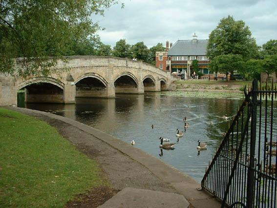
Abbey Park is managed by the Leicester City Council more details on the park can be found here. For some large events, the park gates are sealed. The area is flat and split in two by the River Soar, which forms a lake at its widest point, a canal is the south-eastern edge of the Park. The Cafe is in the centre of the park.
Beginners: Groups with beginners may wish to practice in the Centre of the park using the Star Loop pack. Download the guide and if you want the star loop maps referred to then download these too. As file sizes are large there are two separate packs; you need both. The Youth leader risk assessment should be used as a guide.
Groups: The Young Leader Beginner Advice Sheet (download from here) should help you plan your visit. You should contact the Parks Office who will advise you about other events and may even check all the markers are in place. Contact
Warning about usage: For further information and known issues relating to controls, please see the Leicestershire Orienteering Club website.
Map updated: 2018
There is no legend on the map so download a free Sprint Legend
Courses Available
|
Course |
Controls /Length (km) |
Suitable for |
Estimated (mins) |
|---|---|---|---|
| Start: Abbey Park Car Park | |||
|
White |
8 /0.7 |
Beginner children probably followed by parents |
10-25 |
|
Yellow |
12 /1.4 |
A child with some experience |
15-35 |
|
Orange |
12 /2.4 |
Adult beginner confident junior |
25-50 |
| Start: Pets Corner | |||
|
Orange |
12 /2.3 |
Adult beginner confident junior |
25-50 |
| Start: St Margarets Pasture | |||
|
Yellow |
11 /1.6 |
A child with some experience |
15-35 |
|
Orange |
15 /2.7 |
Adult beginner confident junior |
25-50 |
|
Score |
20 |
Adult or children Some controls are too hard for beginners |
30 |
Feedback
Control markers do get damaged or go missing. Do let us know about any damaged or missing control points, please use our Feedback Form However as volunteers we may not be able to remedy this quickly.
In the park Abbey Ruins, River Soar, Pets Corner
Close to Leicester Golden Mile
Close to Abbey Pumping Station
Close to the National Space Centre
Use the Maprun app Maprun app Garmin watch owners may wish to use the sister app MaprunG, or for Apple watches MaprunA, but you will need a printed course map. Your phone (watch) beeps when you get close to the feature (a virtual control detected by your GPS signal). Upload your results to see your position on the leaderboard.
We suggest you download a MapRun map from here but you can just use the one on your smartphone. There is no legend on the map so download a free Sprint Legend
Courses Available
| Course |
Controls/ Length (km) |
Expected time (mins) |
Suitable for/ Comments |
Results |
| White |
9/ 1.0 |
10-25 | Beginner | |
| Yellow |
10/ 1.9 |
15-35 | Child with some experience | Yellow |
| Orange |
17/ 3.5 |
22-55 |
Adult or experienced child /one control moved Jan 2021 because of safety concerns |
Orange |
| Score 20 | 20 |
Adult or experienced child /20 points per control lose 10 for every minute late |
Score |
To access the Maprun map, scan the QR code. OR
To use the Maprun app when in the car park, start the Maprun app. If you are at the site or are close by, click 'Events near me' or at home, click 'Select Event' and go to the UK/Leicestershire/Abbey Park folder to find the courses. Click the one you want. Click ‘go to Start’ when you are ready. When you get near the start your time begins once your phone beeps.
Beginners there are a couple of features to help you navigate: Before the start, the location and track are always shown. Once you pass the start the location and track disappear ... unless you have enabled 'show track' or 'show location'. These features can be enabled in 'Options and settings' before you start. For some courses, we had added a ‘show me’ feature. Where it's available there is a button on the screen but you can only use it a few times.
Results: Results Enter a time period, Country = UK and County = Leicestershire


